Discover Lake Tahoe: shores, seasons and a route around the lake

High in the Sierra Nevada, Lake Tahoe surprises with the clarity of its water and its coves of rounded boulders. Summer is spent kayaking and hiking, winter on the ski slopes, always with snow-capped peaks as a backdrop.

Why go to Lake Tahoe?

Lake Tahoe is a large alpine lake at about 1,897 meters above sea level, shared between California and Nevada in the western United States. More than 500 meters deep, it is one of the deepest lakes in the country and can be visited all year: hiking and swimming in summer, skiing from December to April.

What to discover around Lake Tahoe, shore by shore?

The South Shore: South Lake Tahoe and Stateline

The South Shore has the largest choice of lodging on the lake. South Lake Tahoe, on the California side, runs seamlessly into Stateline, on the Nevada side, where the casinos stand. Heavenly resort spans both states, with a gondola leaving from downtown. It is the most convenient base for a first stay of three or four days, about 3.5 hours by car from San Francisco on US-50 outside Friday evening traffic. In 2021, the Caldor Fire forced a full evacuation here: in summer, keep an eye on air quality.

Emerald Bay and the West Shore

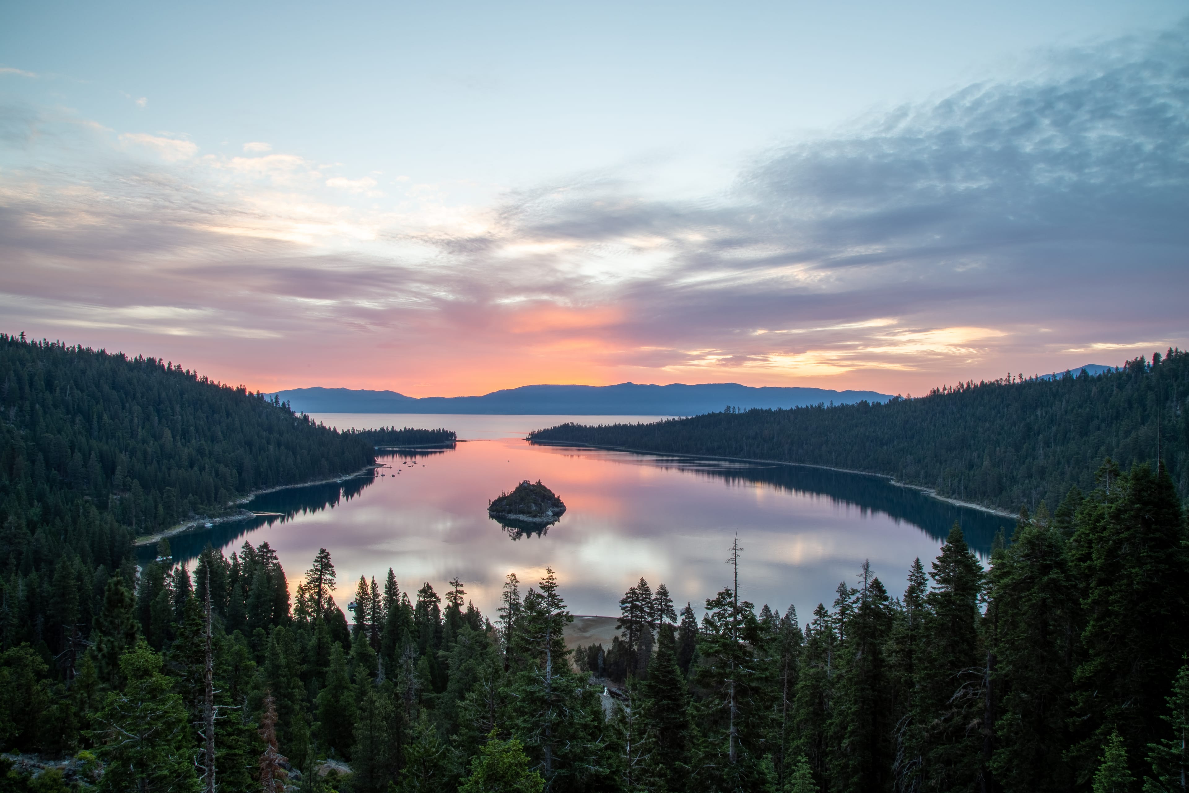
In the southwest, Highway 89 overlooks Emerald Bay, a narrow, enclosed bay with Fannette Island, the lake's only island, rising in its center. The state park adjoins D.L. Bliss State Park, linked by the Rubicon Trail, about 7 km along the water. Further north, the wooded and quiet West Shore is lined with small beaches and vacation homes up to Tahoe City. In winter, the Emerald Bay stretch regularly closes due to avalanche risk: check road conditions on the Caltrans website before setting off.

The North Shore: Tahoe City and Kings Beach

More residential than the south, the North Shore centers on Tahoe City, where the Truckee River leaves the lake, and Kings Beach, a large family beach. A bike path follows the river for several kilometers, and floating down it on a tube or raft is a July classic. For skiing, Palisades Tahoe, formerly Squaw Valley and host of the 1960 Winter Olympics, and Northstar are about twenty minutes away. Reno airport is about an hour's drive.

The East Shore, Nevada side

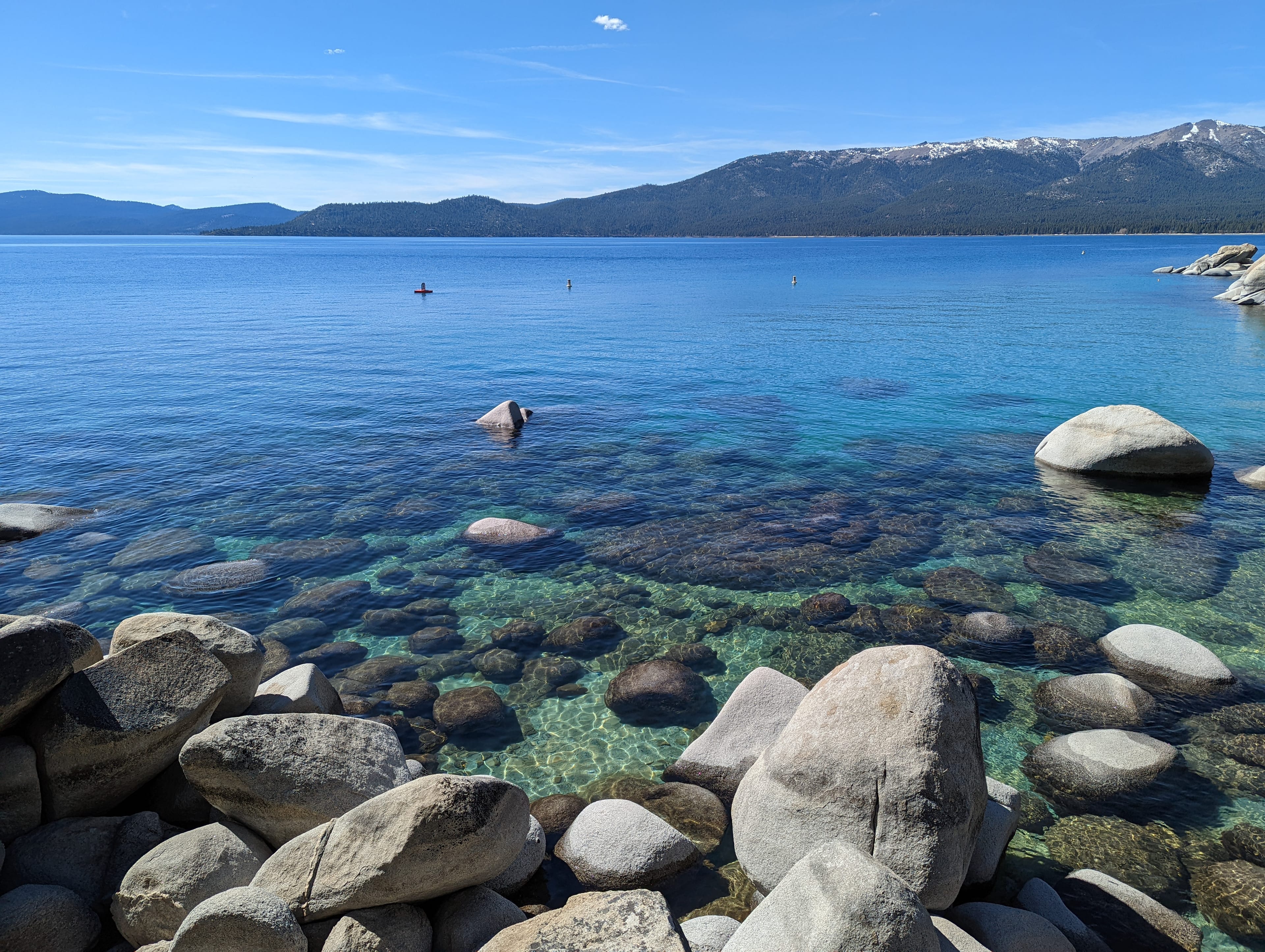
The East Shore is the least developed: forests, pale sand beaches and granite boulders dropping into turquoise water. Sand Harbor, south of Incline Village, is its icon, but its parking lot is often full before 10 a.m. in summer. Since 2019, a paved path of about 5 km, the Tahoe East Shore Trail, has linked it to Incline Village on foot or by bike. In July and August, the Lake Tahoe Shakespeare Festival plays outdoors on the beach at Sand Harbor. To the south, Cave Rock is a sacred site of the Washoe people.

Winter and the ski season

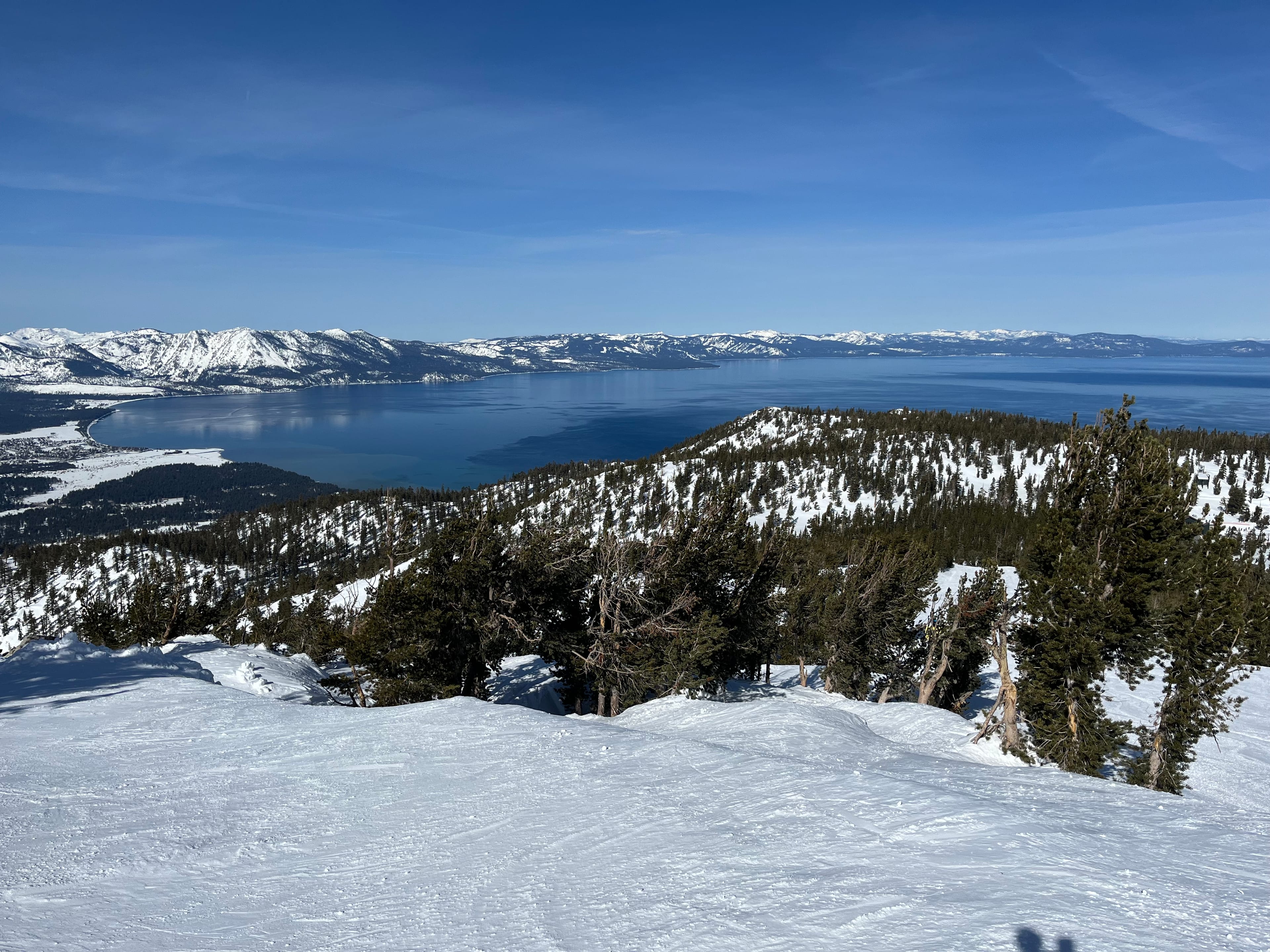
From December to April, around a dozen ski areas surround the lake, including Heavenly, Palisades Tahoe, Northstar and Kirkwood. Pacific storms can dump more than a meter of snow in a few days, and chain controls are then enforced on I-80 and US-50: rental cars without equipment are sometimes turned back. To avoid weekend traffic from the San Francisco Bay Area, arrive midweek. In spring, sunny days and still abundant snow make March a very popular month.
Cities to visit in Lake Tahoe

Featured destinations appear first.
Coming soon.

Lake Tahoe in pictures

Lake Tahoe must-sees

An emerald bay, granite coves and ridge-top trails: the places not to miss around the lake.

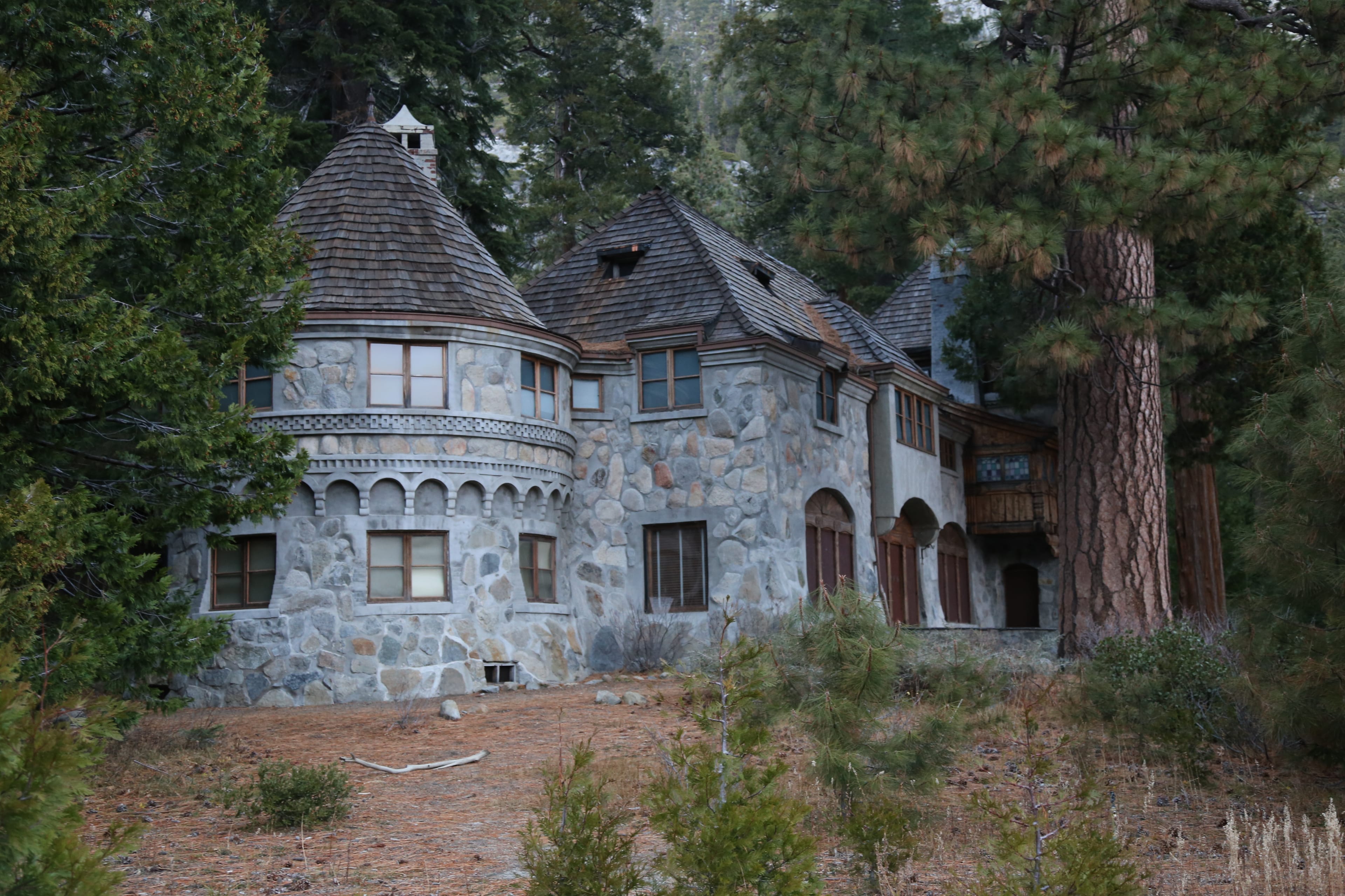
Vikingsholm

Scandinavian-style mansion built in 1929 at the head of Emerald Bay. Reached by a steep path of about 1.6 km from Highway 89, tours in summer.

Sand Harbor

State park with rounded granite boulders and crystal-clear water, ideal for kayaking and paddleboarding. Arrive very early in summer, the lot closes once full.

Heavenly Gondola

Leaving from downtown South Lake Tahoe, it climbs to a panoramic deck above the lake. Open in winter for skiers and in summer for sightseers.

Eagle Falls and Eagle Lake

A waterfall above Emerald Bay, then a small alpine lake about 1.6 km on foot. Gateway to the Desolation Wilderness, with a free day permit.

Tahoe Rim Trail

Long-distance trail looping the entire basin along the ridges for more than 250 km. Several sections can be hiked as day trips.

Rubicon Trail

Shoreline path between D.L. Bliss and Emerald Bay, among the most beautiful on the lake, with views over crystal water and reachable coves.

Frequently asked questions about Lake Tahoe

North Shore or South Shore of Lake Tahoe: where to stay?
The South Shore has the most lodging, the Stateline casinos and Heavenly resort within walking distance. The North Shore is quieter, close to Palisades Tahoe and Reno airport. For Emerald Bay and the West Shore, the south is better placed.
How long does it take to drive around Lake Tahoe?
The road loop is about 115 km. Without stops it takes around 3 hours, but in summer traffic around Emerald Bay and Sand Harbor makes it much longer. Plan a full day with stops, swimming and viewpoints.
Can you swim in Lake Tahoe?
Yes, mostly from July to early September, at beaches such as Sand Harbor, Kings Beach or Pope Beach. The water stays cool and gets colder quickly away from shore: do not overestimate your tolerance for cold, especially on a kayak or paddleboard.
Is the Emerald Bay road open in winter?
Not always. The Highway 89 stretch above Emerald Bay regularly closes after snowfall because of avalanche risk, sometimes for several days. You then have to drive around the east side of the lake to reach the West Shore from the south.
How long does it take to get from San Francisco to Lake Tahoe?
Allow about 3.5 to 4 hours without traffic, via I-80 to the North Shore or US-50 to the South Shore. On Friday evenings and during snowstorms, the drive can easily double.
Where were the 1960 Winter Olympics held near Lake Tahoe?
At Squaw Valley, a North Shore resort renamed Palisades Tahoe in 2021. It remains one of California's major ski areas, about twenty minutes by car from Tahoe City, and the Olympic rings still mark the entrance to the valley.

Plan your trip to Lake Tahoe

Day-by-day itinerary, budget, bookings and packing in a single app.
Aperçu de l'application PlanTripNow