Visit Puerto Rico: what to see, when to go and what it costs

An island 160 kilometres long where a single day takes you from rainforest to limestone cliffs. Puerto Rico lives in Spanish and pays in dollars: night kayaking in glowing bays, the beaches of Culebra, surf in Rincón and high-altitude coffee.
  • 1 city

Why choose Puerto Rico in the Caribbean?

Puerto Rico packs a rainforest, three bioluminescent bays, white-sand beaches and a coffee-growing mountain range into 9,100 sq km. This territory of the United States is best explored by car, with an ESTA for French travellers, ideally from February to April, the driest stretch of the hurricane-free months.

What can you discover in Puerto Rico, area by area?

An American territory that speaks Spanish

Ceded by Spain in 1898, the island remains an unincorporated territory: its residents have been US citizens since 1917, yet daily life runs mainly in Spanish, with English as the other official language. Dollars, American plugs and ESTA rules sit alongside mofongo and street festivals. Compared with its Spanish-speaking neighbours Cuba and the Dominican Republic, it offers fast roads and American prices: allow about 195 euros a day per person for a comfortable trip. There is no direct flight from Paris, so plan on one stop, often in the United States.
The north-east, from forest to the Fajardo lagoons

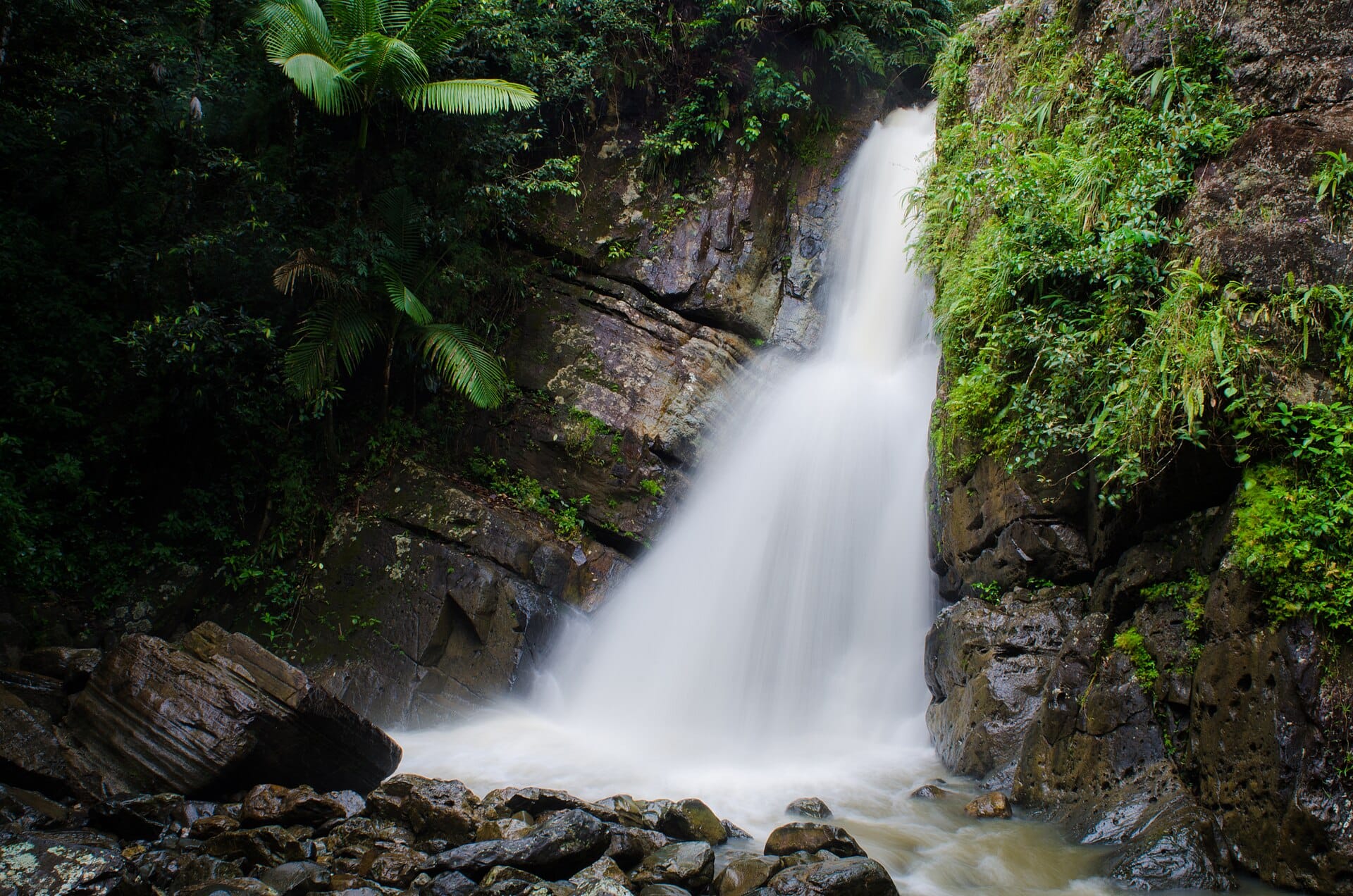
Close to San Juan airport, this corner of the island fits into three days. El Yunque National Forest, some 11,000 hectares, climbs above 1,000 metres. Access to some trails, including La Mina, should be checked on the official Forest Service website before heading up. The Luquillo kiosks make an easy lunch stop, and in the evening you reach Fajardo's Laguna Grande by kayak through a mangrove channel. Leave early for the forest, as the car parks fill during the morning.

Culebra and Vieques, the eastern islands

From the Ceiba terminal, the ferry takes about 45 minutes to Culebra and 30 minutes to Vieques; book early for weekends and public holidays. Five days lets you see both. Culebra is all about reefs and turtles, Vieques about space, with free-roaming horses and the former military land of the US Navy, which left in 2003 and handed it over as a national refuge. Inside the refuge, stick to open roads and beaches, as some sectors remain closed to the public. Rent a jeep on the spot: the tracks suit one better than a small car.

Rincón and the west coast

On the opposite side of the map from San Juan, this coast faces the Mona Passage. Rincón made its name by hosting the world surfing championships in 1968: the winter swell, from November to March, keeps Domes and Tres Palmas for experienced surfers. In summer the sea calms down and a snorkel replaces the board at Steps Beach. From January to March, humpback whales pass offshore and can sometimes be spotted from the coast. Two nights are enough, three if you take a surf lesson.

The south, from Cabo Rojo to the Pearl of the South

The southern slope gets far less rain, about 920 mm a year against 1,520 mm in San Juan, and the scenery shifts: pink salt flats and limestone cliffs at Cabo Rojo, dry forest at Guánica, a UNESCO biosphere reserve since 1981. In the evening, La Parguera runs boat trips among the mangrove cays. Ponce, linked to San Juan by motorway, deserves a night for its Creole facades and the Museo de Arte. Aim for February for its carnival and vejigante masks.

The central range and its coffee roads

In the middle of the island, the Ruta Panorámica crosses the island from east to west as far as Mayagüez on narrow roads: never plan more than two or three hours of driving a day. Jayuya and Adjuntas open their plantations for tastings, usually by reservation. Toro Negro forest spreads below Cerro de Punta, the island's highest point, where the air is noticeably cooler than on the coast. One night in the mountains is enough to close a western loop, and a light jacket is no luxury there.

The karst country of the north

Between Arecibo and Utuado, limestone has carved haystack hills, sinkholes and caves hollowed out by rivers. It works as an excursion from San Juan or as the first stage of a seven-day island loop via the west. The giant Arecibo radio telescope collapsed in December 2020: the site is no longer the observatory it once was, so check that its education centre is open before driving up. Closed shoes are essential, as the ground stays slippery all year.

Hurricanes, earthquakes and the best time to go

Hurricanes are a threat from 1 June to 30 November, with peak risk from August to October: Hurricane Maria devastated the island in September 2017, and the power grid still bears the marks. Late December and January combine fine weather with full hotels, at over 90% occupancy at the peak. February to April remains the best compromise, with May the bargain before the rains. The island also sits in an active seismic zone, so note the tsunami evacuation routes on the coast. To compare with a French island, see Guadeloupe, or the whole arc of the Caribbean.

Cities to visit in Puerto Rico

Featured destinations appear first.

Puerto Rico in pictures

Places not to miss in Puerto Rico

Nine specific places, easy to fit into a road loop or link by ferry.

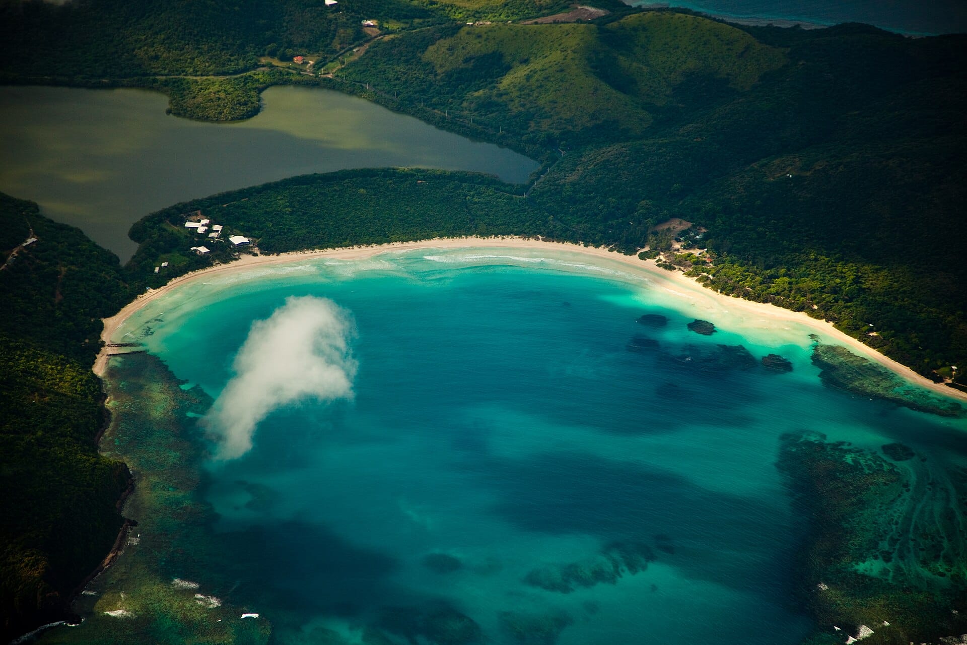
Flamenco Beach

A crescent of white sand on Culebra with turquoise water and rusting old tanks, relics of the years when the US Navy trained on the island.

Mosquito Bay

Vieques' famous bioluminescent bay is explored at night by kayak or electric boat. Swimming is banned, and moonless nights give the best results.

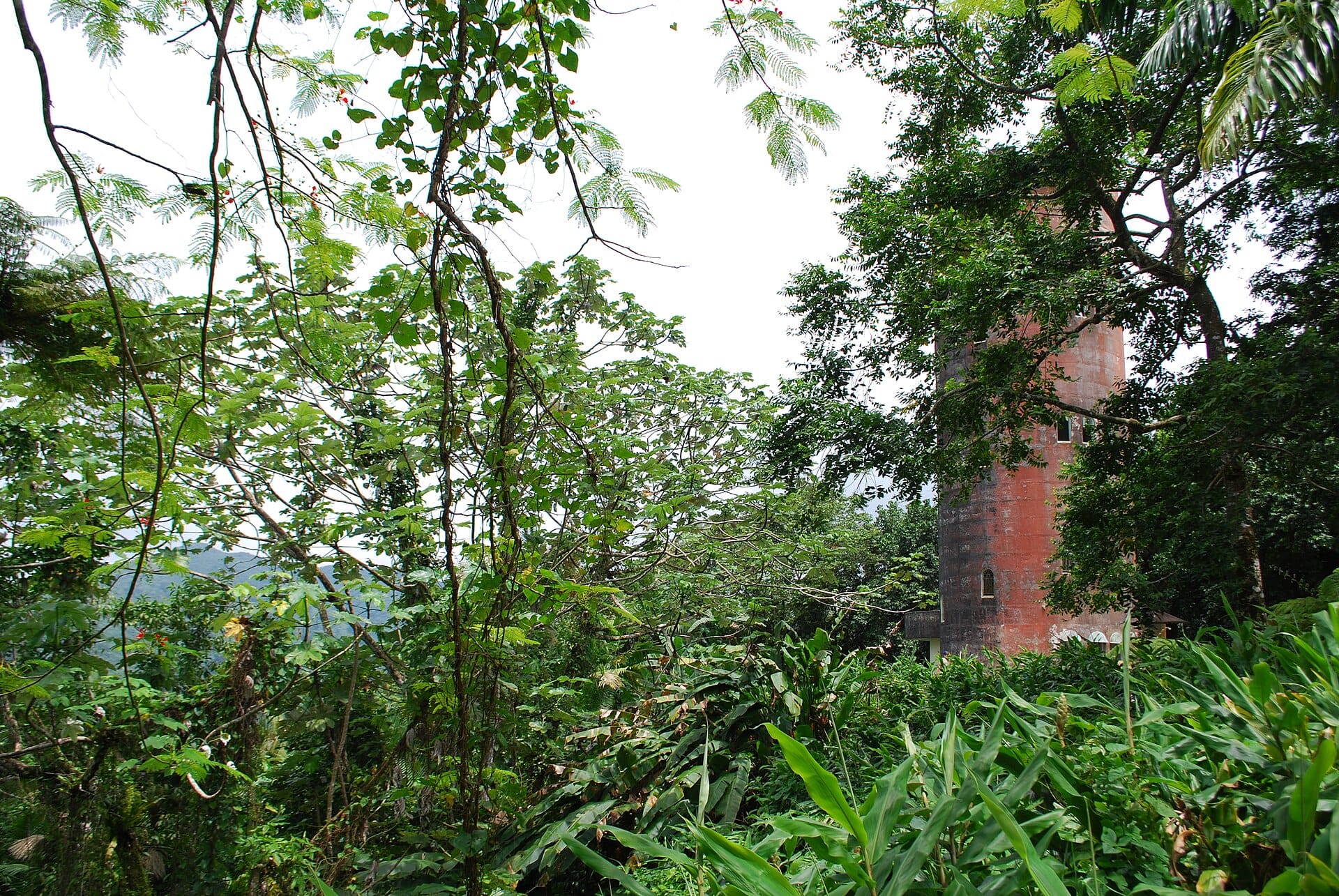
Yokahú Tower

This stone observation tower beside the road through El Yunque gives a clear view over the canopy and the north-east coast.

Cueva Ventana

A cave near Arecibo whose opening frames the Río Grande valley. Access is with a guide only, after a short walk.

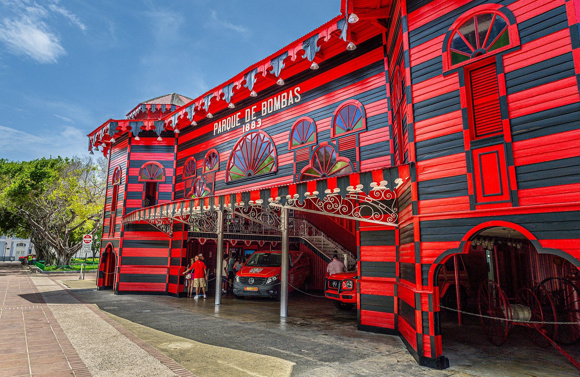
Parque de Bombas

Ponce's old firehouse, striped in red and black and built for the 1882 exhibition, stands out on the Plaza Las Delicias.

Los Morrillos Lighthouse

Perched on top of Cabo Rojo's limestone cliffs, it overlooks La Playuela beach and the nearby salt flats at the island's south-west tip.

Hacienda Buena Vista

A restored nineteenth-century plantation above Ponce with its water-driven coffee machinery. The guided tour has to be booked well in advance.

Piedra Escrita

A large boulder covered in Taíno petroglyphs beside a river in Jayuya, one of the most accessible traces of pre-Columbian culture.

Cayo Icacos

An uninhabited sandy islet off Fajardo, reached by day-trip catamaran, for swimming and snorkelling in the clear waters of the nature reserve.

Frequently asked questions about Puerto Rico

Do French citizens need an ESTA to fly to Puerto Rico?
Yes, Puerto Rico follows United States entry rules. You need an electronic or biometric passport and an ESTA, about USD 40, valid for two years. Arriving by private yacht or plane, an ESTA is not enough and a visa is required.
Can you swim in the Vieques bioluminescent bay?
No, swimming is banned in Mosquito Bay to protect the microorganisms. You visit at night by kayak or electric boat with a licensed operator, for about USD 60 to 110 depending on the provider. Choose a moonless evening.
Which bioluminescent bay is best: Mosquito Bay, Fajardo or La Parguera?
Mosquito Bay on Vieques has the strongest reputation but requires a ferry. Fajardo's Laguna Grande can be done without leaving the main island, with a fine mangrove paddle. La Parguera fits neatly into a loop through the south.
Can you visit Puerto Rico without renting a car?
Only in San Juan and on short organised excursions. For Rincón, Ponce or the central range a car is almost essential, as practical intercity public transport is lacking. Allow USD 30 to 80 a day depending on guides and season.
Culebra or Vieques: which is better for two days?
Culebra if you want a headline beach and snorkelling with turtles, Vieques if you want the bioluminescent bay and near-empty beaches. With five days, do both, going back through Ceiba between ferries.
Is September a risky month for a trip to Puerto Rico?
It is the heart of hurricane season, with peak risk from August to October: Maria struck in September 2017. If you still go, take cancellation insurance, book flexible rates and follow the National Hurricane Center.
Can you hike in El Yunque and see La Mina falls?
The forest can be visited, but trail conditions change. For La Mina and the other routes, access should be checked on the official Forest Service website before you travel, then once more the day before your visit.
What is left to see at the Arecibo Observatory?
The giant radio telescope collapsed in December 2020 and can no longer be visited as before. The site has been refocused around an education centre, whose opening should be checked. Nearby Cueva Ventana is a better reason for the detour.
How much does a week in Puerto Rico cost for two people?
Flights included, allow about 2,600 euros on a budget, 4,300 euros in comfort and 6,800 euros for premium. A return flight from Paris runs at around 650 to 900 euros per person, excluding the year-end holidays.

Plan your trip to Puerto Rico

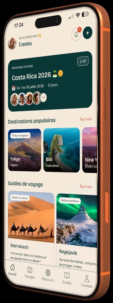
Day-by-day itinerary, budget, bookings and packing in a single app.
Aperçu de l'application PlanTripNow