Visit Provence-Alpes-Cote d'Azur: when to go and where to head

The Provence-Alpes-Cote d'Azur region runs from the Camargue to the Italian border and from the Mediterranean to the 4,000-metre summits of the Mercantour. It brings together Marseille and the calanques, village Provence, the Verdon canyon, the French Riviera and six departments with very different climates. A week forces you to pick one area.

Why visit Provence-Alpes-Cote d'Azur?

No other region of France puts a Mediterranean coast, Europe's largest canyon, lavender fields and glaciers within such a short distance. PACA gathers historic Provence, the French Riviera and the Southern Alps, that is two national parks, several World Heritage sites and the country's strongest sunshine.

What is there to discover in Provence-Alpes-Cote d'Azur?

Marseille, the metropolis and the calanques

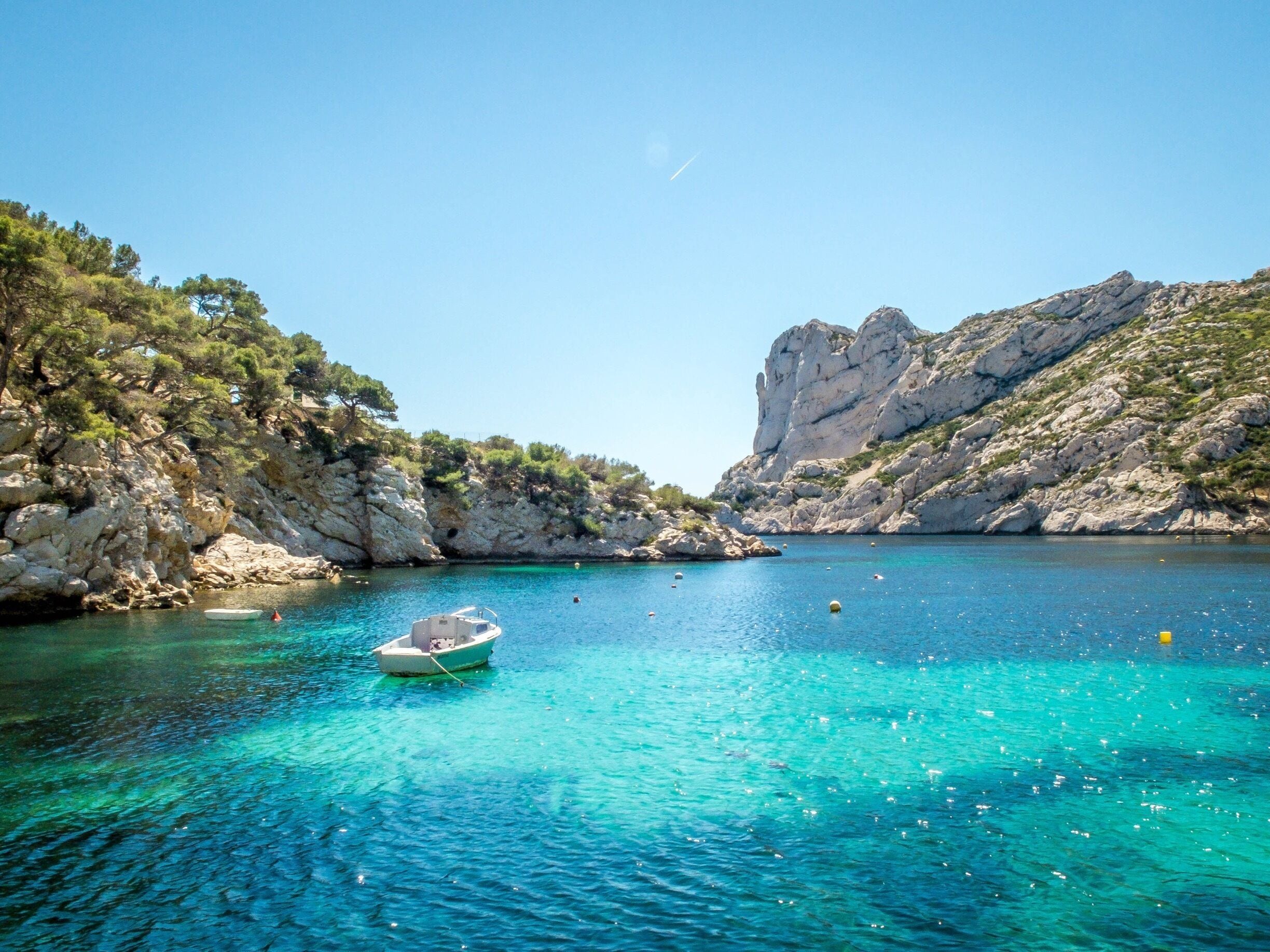
France's second city and its oldest, Marseille is discovered from the Vieux-Port to the Panier quarter, with the MuCEM and Fort Saint-Jean linked by a footbridge, Notre-Dame-de-la-Garde and the boat shuttle to the Chateau d'If. To the south, the Calanques national park protects 20 kilometres of limestone cliffs pierced by coves: Sormiou, Morgiou and En-Vau are reached on foot from Luminy or by boat from Cassis. In summer, road access to some calanques is closed or subject to booking for fire risk, and a sea shuttle serves the main ones from the Vieux-Port. Allow two days for the city and one for a hike in the massif.

Historic Provence: Avignon, Arles and the Luberon

The north-west of the region carries the classic image of Provence. Avignon keeps the Palais des Papes and its ramparts, Arles its Roman arena and theatre still in use, and the Luberon its hilltop villages, Gordes, Roussillon and its ochre, Menerbes, Bonnieux. Senanque abbey is photographed in front of its lavender from mid-June to mid-July, and l'Isle-sur-la-Sorgue holds its antiques market on Sunday. The Pont du Gard, a three-tier Roman aqueduct, is 25 minutes from Avignon. This area is covered over short distances but saturates in July, during the Avignon Festival.

Aix-en-Provence and Cezanne country

The former capital of Provence, Aix lines up the Cours Mirabeau and its fountains, the mansions of the Mazarin quarter and a market every morning. Cezanne's studio has been kept in its 1906 state, and Mont Sainte-Victoire, which he painted more than eighty times, is hiked from the Bimont dam, about 4 hours to the Croix de Provence. Around it, the villages of the Aix country, Ventabren, Le Tholonet, and the Sainte-Baume site, an ancient forest and a pilgrimage cave at 1,000 metres, offer cool air less than an hour from the coast.

The Verdon, Europe's largest canyon

Between Sainte-Croix lake and Castellane, the Verdon has carved gorges 700 metres deep. The Route des Cretes, from La Palud-sur-Verdon, strings together fourteen viewpoints on a 23-kilometre loop. At the bottom, the Blanc-Martel trail, 15 kilometres and about 6 hours, is walked with a shuttle for the return and a torch for the tunnels. Turquoise Sainte-Croix lake is good for kayaking and pedalos from the Galetas bridge. Moustiers-Sainte-Marie, clinging under a cliff, and Aiguines guard the western and southern entrances. The area is saturated in July and August and access can be regulated.

The Var coast, from Bandol to the Hyeres islands

Between Marseille and Saint-Tropez, the Var coast alternates calanques, ports and vineyards. Bandol and Cassis produce seaside wines, the Giens peninsula closes a double tombolo, and offshore, the Hyeres islands, Porquerolles, Port-Cros and the Levant, form a marine national park: clear water, trails, no cars. Porquerolles is reached in 20 minutes by boat from the Tour Fondue and is toured by bike. The Maures massif, behind, is covered with chestnut and cork oak forests, with the hilltop villages of Collobrieres and Bormes-les-Mimosas.

The French Riviera, from Cannes to Menton

The eastern part of the coast, around Nice, forms the French Riviera: Cannes and the Croisette, Antibes and the Picasso museum, Old Nice and the Cours Saleya, Monaco and the corniches, Menton and its citrus gardens at the Italian border. The regional train links all these towns without a car. Behind, the hilltop villages of Saint-Paul-de-Vence, Eze and Gourdon, the Maeght foundation and the Grasse perfume houses round off the visit. This is the most built-up and expensive area of the region, especially in July-August and during the Cannes Film Festival and the Monaco Grand Prix in May.

The Southern Alps: skiing, Queyras and Ubaye

The Hautes-Alpes and the north of the Alpes-de-Haute-Provence offer a completely different face: Serre Chevalier, Montgenevre and Isola 2000 for skiing from December to April, the Queyras nature park and its fortified village of Saint-Veran, the highest in Europe lived in year-round at 2,040 metres, and the Ubaye valley around Barcelonnette, marked by 19th-century emigration to Mexico. In summer, these valleys are hiked, run in whitewater and cycled over the passes of the Galibier, the Izoard and the Bonette, France's highest road at 2,802 metres.

The Mercantour and the Nice hinterland

The Mercantour national park, the region's only alpine park, stretches from the Ubaye valley to the Roya. The Vallee des Merveilles, at the foot of Mont Bego, holds over 30,000 Bronze Age rock carvings, seen only on foot with a licensed guide. The Vesubie, Tinee and Roya valleys, devastated by storm Alex in 2020 and since rebuilt, keep Baroque villages such as Saorge and Tende, the Train des Merveilles toward Ventimiglia, and alpine wildlife, ibex, chamois, and wolves that have returned naturally since 1992.

Cities to visit in Provence-Alpes-Côte d'Azur

Featured destinations appear first.
Coming soon.

Provence-Alpes-Côte d'Azur in pictures

Region highlights

Eleven sites showing the gap between the sea and the high mountains.

Calanque d'En-Vau

The most spectacular of the Marseille calanques, turquoise water between two 100-metre cliffs, reached on foot in 1h30 or by boat from Cassis.

Verdon gorges

A 25-kilometre canyon up to 700 metres deep, with the Route des Cretes, the Blanc-Martel trail and Sainte-Croix lake at its entrance.

MuCEM

The museum of European and Mediterranean civilisations, a lace-like concrete cube on the Marseille waterfront, linked to Fort Saint-Jean by a footbridge.

Mont Sainte-Victoire

A 1,011-metre limestone ridge near Aix, Cezanne's obsessive subject; a trail to the Croix de Provence in 4 hours round trip.

Porquerolles island

The largest of the Hyeres islands, in a national park, car-free, with pale-sand beaches, vineyards and 50 kilometres of cycle tracks.

Palais des Papes

Europe's largest Gothic palace, in Avignon, home to nine popes in the 14th century; a World Heritage site with the bridge and ramparts.

Sainte-Croix lake

A turquoise 2,200-hectare reservoir at the western entrance of the Verdon; swimming, kayaking and pedalos, with the village of Bauduen on the shore.

Serre Chevalier

A large Hautes-Alpes ski area between 1,200 and 2,800 metres, in the Guisane valley near Briancon, a town fortified by Vauban.

Vallee des Merveilles

A Bronze Age rock-art site at the foot of Mont Bego, in the Mercantour; over 30,000 carvings, guided access compulsory.

Valensole plateau

A vast farming plateau covered with lavender and wheat, in flower from mid-June to mid-July, between Manosque and the Verdon.

Old Nice and Cours Saleya

A maze of Italian-style lanes in the heart of Nice, with a flower and produce market Monday to Saturday and antiques on Monday.

Similar regions

Other regions you might like as much as Provence-Alpes-Côte d'Azur.

Similar destinations

Other countries you might like as much as Provence-Alpes-Côte d'Azur.

Frequently asked questions about the region

What exactly does Provence-Alpes-Cote d'Azur cover?
Six south-eastern departments: Bouches-du-Rhone, Vaucluse, Var, Alpes-Maritimes, Alpes-de-Haute-Provence and Hautes-Alpes. The region runs from the Camargue to the Italian border and from the Mediterranean coast to the summits of the Mercantour and the Ecrins, above 4,000 metres.
What is the difference between PACA, Provence and the French Riviera?
PACA is the administrative region. Provence is its historic and cultural heart, around Avignon, the Luberon and Arles. The French Riviera is the eastern part of its coast, from Cannes to Menton. The Southern Alps, finally, form its mountain half, often overlooked.
How many days to visit the PACA region?
You cannot see it all in one go. Allow a week per major area: Provence and the Luberon, the French Riviera, or the Verdon and the Southern Alps. A first ten-day trip often combines Marseille, Provence and a getaway to the Verdon.
Can you ski in the south of France?
Yes. The Southern Alps have around thirty resorts, including Serre Chevalier, Montgenevre, Isola 2000 and Orcieres, open from December to April. Isola 2000 is under two hours from Nice: in spring you can ski in the morning and be on the beach in the afternoon.
How do you access the Marseille calanques in summer?
On foot from the Luminy, Callelongue or La Gineste car parks, or by boat from the Vieux-Port or Cassis. In July and August, pedestrian access to Sugiton and En-Vau needs a free online booking, and the Sormiou road closes on days of high fire risk.
When can you see the lavender in the region?
From mid-June to mid-July in the Luberon and on the Valensole plateau, and until mid-August on the higher Sault plateau. The fields are harvested once the bloom passes: aiming for the first half of July is safest.
Which airport to visit Provence-Alpes-Cote d'Azur?
Nice for the French Riviera and the Nice hinterland, Marseille-Provence for Marseille, Provence and the Verdon. Both connect to the high-speed rail network and have plenty of car hire, essential once you leave the coast.
Verdon: how do you plan a day in the gorges?
In the morning, the Route des Cretes from La Palud-sur-Verdon and its viewpoints; in the afternoon, swimming or kayaking on Sainte-Croix lake from the Galetas bridge. The Blanc-Martel trail, at the bottom of the canyon, needs a full day on its own, with a shuttle.
Can you combine sea and mountains in a week in the south?
Yes, staying in the east of the region: two or three days on the French Riviera, then the Tinee valley and Isola, or the Mercantour, less than two hours' drive away. Combining Marseille and the Hautes-Alpes in the same week is too ambitious.
Where can you see flamingos and wolves in the region?
Pink flamingos live year-round in the Camargue, at the Pont de Gau bird park and on the Vaccares lagoon. Wolves, back naturally from Italy since 1992, are very hard to spot in the Mercantour; the Alpha park, at Saint-Martin-Vesubie, shows them in semi-freedom.

Plan your trip to Provence-Alpes-Côte d'Azur

Day-by-day itinerary, budget, bookings and packing in a single app.
Aperçu de l'application PlanTripNow